


Part of “Acadia’s 30 Best Trails“
Photos by Chris Shane
1. Gorge Path
The trail that most starkly illustrates Cadillac’s capacity for quietude is the Gorge Path, as its route more or less parallels the uber-popular North Ridge Trail. Unlike the high and dry North Ridge, the narrow chasm between Cadillac and Dorr is damp, dark, and cool — the echoey nave of a medieval cathedral, with trees for columns and cliffs for walls. The trail eventually emerges at the saddle between Cadillac and Dorr, and turning right leads up steep, exposed ledges — which are daunting enough to inspire a return loop back along the North Ridge and Kebo Brook trails. 1.9 miles one way from a pullout on the Park Loop Rd., a mile east of the intersection with Paradise Hill Rd. 4.8-mile loop if descending via the North Ridge Trail.
2. North Ridge
You won’t be alone heading up Cadillac’s north face, as quite a few hikers opt for this fairly short route to the summit. They enjoy the same views from exposed granite ridges as on other routes, but with several sets of granite stairs to hasten the ascent and a few short stretches that run right alongside the busy auto road. It’s a perfectly pleasant route, but it’s best for those who are pressed for time and aren’t put off by the dull rumble of nearby car engines. 2.2 miles one way from the Cadillac North Ridge trailhead, on the Park Loop Rd., a mile north of the Cadillac Summit Rd.
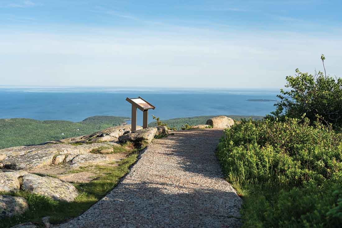
3. South Ridge
Though it climbs some 1,400 feet, the South Ridge Trail feels leisurely. Its first third ascends gently through white pine and spruce before leaving the trees at a lookout called Eagle Crag. Then, blazes and cairns lead across pink-granite ridges where little interrupts views of the ocean and surrounding hills. About a mile below the summit is an alpine bog where lichens and marsh grasses fill pools in the glacially scoured rock, strange little gardens, and the Featherbed, a shallow cirque pond and perfect lunch stop. The summit’s crowded with folks who took the auto road, but it offers views as far as Katahdin on a clear day. 3.5 miles one way from the Cadillac South Ridge trailhead, on Rte. 3, just west of Blackwoods Campground.


Along the South Ridge Trail, cairns, signs, and blazes mark a pathway across the long, striated granite ridge, and the pond known as the Featherbed is a natural rest stop. Click an image to enlarge.
4. West Face
Even shorter than the North Ridge Trail and, as a consequence, wicked steep — hikers gain nearly 1,200 feet in less than a mile. The competent and sure-footed will enjoy scrambling over boulder fields and navigating a few tricky overhangs, but less-experienced hikers and folks with kids or dogs should think twice. The payoff for that grueling climb is a vista taking in Bubble Pond, Eagle Lake, and Pemetic Mountain that you can’t get on any other trail. For the last half mile before the summit, the West Face Trail joins the South Ridge Trail. If you can make this one a shuttle, consider taking another route down, as it’s less fun to descend. .8 mile one way from the Bubble Pond Carriage Road trailhead, 2.5 miles north of Jordan Pond House.
Read up on all 30 of our favorite Acadia National Park trails.
