
By Charlie Pike
From our August 2025 issue
On the state Department of Agriculture, Conservation & Forestry website, an interactive map tracks every bit of conserved land across all of Maine. Check only the box for federally protected lands, and gray-shaded shapes are superimposed on the map. Those take up relatively little space, representing Acadia National Park, Katahdin Woods and Waters National Monument, a corner of White Mountain National Forest bleeding over from New Hampshire, the thin ribbon of the Appalachian Trail corridor, and a smattering of wildlife refuges and experimental forests. Check the box for state-owned lands and a turquoise patchwork of state parks, public reserved lands, and wildlife-management areas appears, dwarfing the gray. Municipal parks and woods contribute tiny bursts of yellow. Then, add privately conserved lands to the mix for a profusion of pink, easily the most abundant color. The overall impression is that someone cracked open a kaleidoscope and strewed its contents across the map.
Some of those pink parcels, particularly in the north woods and way down east, span large contiguous swaths, while others, especially in heavily developed coastal areas, cover only the tiniest of dots. Mostly, they indicate either land owned by a land trust or land to which a trust holds a conservation easement. Scrutinizing the map — zooming in and out, scrolling north, south, east, and west past jumbles of contrasting colors and odd geometry — a person might feel inspired to move from the virtual world to the real, to see what one of those smallest of pink flecks really signifies. In Windham, for instance, the map shows an itty-bitty quadrilateral, less than an acre, tucked within what looks from above like a residential area. A note embedded in the map clarifies “no public access.” But that doesn’t preclude driving by for a look.
From what seems to be the roadside boundary of the Windham lot, a short trail dips through the woods toward a lazy stream. Dirt is piled up for mountain-bike jumps. One recent afternoon, a few plastic children’s bikes were strewn about, and a discarded snack-size bag of Takis chips was snagged in some scrub. The surrounding neighborhood was quiet, and even just lingering at the edge of the property felt like trespassing. It all begs the question: Why would a land trust go to the effort of protecting an unremarkable bit of woods sandwiched between homes and unconnected to any other conserved land?
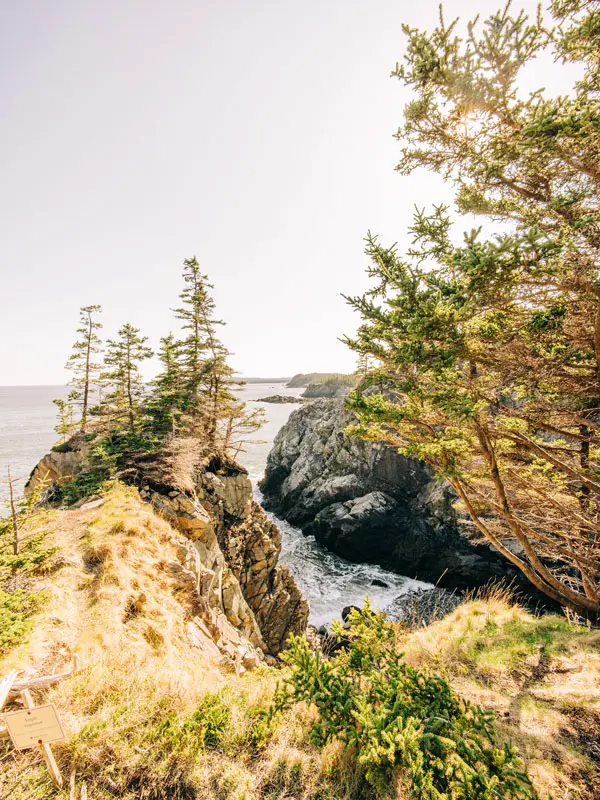
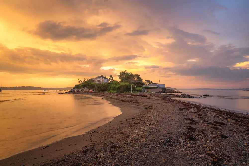
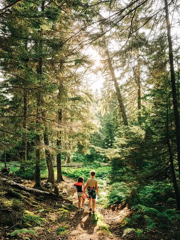
Clockwise from top left: the town of Harpswell’s Giant’s Stairs trail is a complete circuit thanks to additional land acquired by Harpswell Heritage Land Trust (photo by Benjamin Williamson); Coastal Rivers Conservation Trust’s Big Huckleberry Island, on the Damariscotta River (phot by Cara Dolan); Western Foothills Land Trust’s Twin Bridges Preserve, in Otisfield (photo by Cait Bourgault); Salt Bay Farm, in Damariscotta (photo by Cara Dolan); and Shepard’s Farm Preserve, in Norway (photo by Cait Bourgault).
The Many Missions of Maine Land Trusts
Part of the answer is that land trusts in Maine have been filling a void. Of all the New England states, Maine contains the lowest percentage of public land relative to its entire area, just 6.9 percent, according to data compiled by the Maine Land Trust Network (Rhode Island, at 11.6 percent, is the next lowest). What Maine lacks in public land, land trusts have strived to make up for by conserving private land. Today, Maine hosts 84 land trusts, more per capita than any other state in the country, and the Maine Land Trust Network’s latest census shows that those trusts have collectively conserved 2.93 million acres, equal to almost 15 percent of the state’s land base.
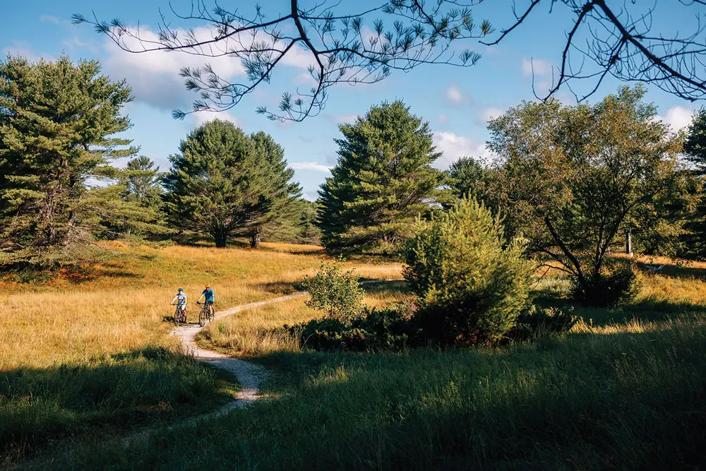
A land trust is, essentially, a nonprofit conservation group whose chief aim is to raise money either to acquire land or to buy conservation easements on land owned by other private entities, for the sake of protecting the land from future development. The precise missions and geographic purviews of individual land trusts, though, can vary. Some focus on specific areas, like with the Sebasticook Regional Land Trust’s protection of the Sebasticook River watershed. Others, such as the Trust for Public Land, take on projects throughout Maine and across the country. Some trusts might be particularly keen on saving wildlife habitat, while others might put more emphasis on recreation (trust-protected properties provide about 3,500 miles of public trails in Maine) or traditional uses (the vast majority of Maine trust lands remain open to hunting and sustainable forestry). Some trusts are working closely with local officials to create comprehensive plans for their communities, while others are focused on acquiring land to return to Wabanaki tribes.
Because of the body of work of land trusts, private ownership has become the predominant mode of land conservation in Maine, filling a role that government plays more prominently in much of the country. But even just half a century ago, the very idea that private organizations and individuals could protect so much of Maine would have seemed far-fetched. How, then, did a bunch of mostly scrappy, grassroots groups, working independently of each other, find a way to redraw the map?
From Maine’s First Land Trust to New Models of Conservation
In the late 1800s, Mount Desert Island was dotted with village-improvement associations composed of both year-round and summer residents concerned with managing the development of communities in accordance with their quaint character. Around the same time, Charles W. Eliot, one of those summer residents and the former president of Harvard, stumbled across an article drafted by his late son, for the journal Garden and Forest, advocating for the preservation of public access to Maine’s most scenic vistas. At the time, resource management and conservation were becoming increasingly popular causes across the country, but unlike out West, where the federal government already owned large swaths of unsettled land from which national parks and forests could be carved, most of Maine and other East Coast states was in private hands. Inspired, Eliot pitched the village-improvement associations to incorporate what could be looked back on as the state’s first land trust, the Hancock County Trustees of Public Reservations.
The group formed in 1901 and quickly set about acquiring and protecting natural landmarks like Champlain and Cadillac mountains. By 1916, the trustees had cobbled together 5,000 acres. But rather than continue to manage the land themselves, they donated it to the federal government. Three years later, what’s now called Acadia National Park was officially designated by Congress.
The next several decades saw a handful of organizations crop up and begin purchasing properties — the Maine chapter of the Nature Conservancy formed in 1956 and made its first purchase, of Step Falls, in Newry, in 1961. In 1970, Peggy Rockefeller spearheaded the creation of Maine Coast Heritage Trust (her husband, David, was the son of John D. Rockefeller Jr., who had been instrumental in the creation of Acadia). In its first year, Maine Coast Heritage Trust managed to protect 30 islands. Its first open-to-the-public preserve, Witherle Woods, in Castine, debuted in 1985. That’s right around when land trusts started to catch on around the state. “At the time, Maine was experiencing a development boom, and people, local people especially, were concerned about the impacts,” says Matt Markot, director of Loon Echo Land Trust, which formed in 1987.
Many fledgling trusts got help from Maine Coast Heritage Trust, which provided loans to other trusts and served as something of a blueprint for them and also created the Maine Land Trust Network as a means of sharing information and tracking progress across trusts. It was the dawn of what Markot dubs a “golden age” of land-trust coordination.
The Forest Society of Maine formed in 1984 with a focus on the north woods, and it has now helped conserve more than a million acres, more than any other land trust in the state. Many other trusts stayed relatively small, focusing on preserving maybe a few acres here or a few hundred there. “Lands would get posted that people had hunted on or hiked on — all of a sudden, these lands are threatened, public access is being threatened,” Maine Coast Heritage Trust public-policy director Jeff Romano says. “So, generally, what happened was organizations formed around protecting particular, iconic parts of their community or region.”
The proliferation of land trusts was aided by a 1969 state law that laid the framework for conservation easements. No longer did groups need to have enough money to buy land outright. Instead, they only needed enough to buy its development rights. Selling — or donating — an easement held appeal to landowners, too, who might not have wanted to part with their property but liked the idea of seeing it forever protected. Trusts, as holders of easements, became legally responsible for ensuring that the terms were abided by current and subsequent landowners. Across Maine, the impact of easements has been dramatic: while land trusts own about 718,000 acres outright, easements account for another 2.2 million acres of trust lands.
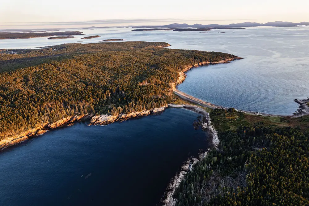
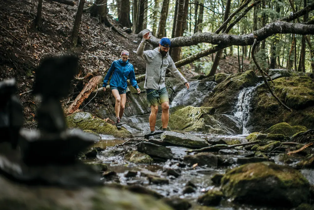
Clockwise from top left: Maine Coast Heritage Trust’s Frenchboro Preserve, on Frenchboro Long Island (photo by Chris Bennett); Loon Echo Land Trust’s Pleasant Mountain Preserve overlooks Moose Pond (photo by Darylann Leonard); Harpswell Heritage Land Trust’s Skolfield Shores Preserve (photo by Benjamin Williamson); Loon Echo Land Trust owns more than 2,000 acres on Pleasant Mountain, in Bridgton and Denmark (photo by Darylann Leonard); Maine Coast Heritage Trust’s Boot Head Preserve, in Lubec (photo by Dave Waddell).
A downside of this approach is that large contiguous swaths of natural spaces are difficult to create, and public access can be spotty (some easements allow for it, and others don’t). That’s how a patchwork map of privately conserved lands gradually takes shape, with odd microparcels in the middle of neighborhoods. But there isn’t much of an alternative these days. Creating a national park, say, was never an easy task, and the challenges are only heightened now, with the federal budget a source of perpetual strife. When Burt’s Bees cofounder Roxanne Quimby wanted to gift the federal government tens of thousands of acres she worked for years to acquire in northern Maine, for a new national park, she faced opposition in Congress as well as from a vocal subset of the local community, in particular from residents of surrounding areas who worried about possible restrictions on hunting and timber harvesting. The project got stuck in limbo for years, until, in 2016, President Obama designated Quimby’s parcel as the Katahdin Woods and Waters National Monument (unlike national parks, national monuments don’t require congressional approval). The odds of accomplishing something similar anytime soon would seem incredibly long.
Private conservation can also appeal to the local population because, while federal- and state-owned lands are exempt from municipal property taxes, privately owned lands with conservation easements on them remain a part of the local tax base (although their value might be diminished by the removal of development rights). And even though nonprofit-owned land is generally exempt from property taxes too, trusts have often negotiated arrangements to continue paying local taxes — in all, about 93 percent of trust-conserved land in Maine remains taxable. “Having grown up here, there’s just a very strong ethic of local control,” says Angela Twitchell, senior director of partnerships and public policy at Maine Coast Heritage Trust. “I feel like that bled through to the creation of land trusts.”
Plus, a place like Massachusetts or Connecticut, with a bigger economy and higher tax revenues, has more money to spend on conservation or parks and recreation at the municipal and state levels. In Maine, land trusts have stepped up to “bring private dollars and volunteer time and things like that to the table, to provide this service that, in other places, maybe the municipality does, or maybe the county does, or maybe the state does,” Romano says.
The role of land trusts, Twitchell says, continues to evolve. She describes what people involved in land-trust work sometimes divide into three eras. In the 20th century, conservationists focused mainly on saving land from development for the sake of ecological diversity, habitat protection, and natural resources. A few decades ago, land trusts began to attune themselves more to the connection between land and the way people use it — preserving access for clammers on land abutting mudflats, for instance, or focusing on sustainable forestry to support the local economy. Now, there’s been a pivot toward community engagement, with trusts partnering with local schools, providing financial and technical support with the crafting of towns’ comprehensive plans, and expanding community programming. The idea today, Twitchell says, is “focusing on building trusting relationships to move this work forward together.”
Land Trusts and the Land Back Movement
Some land trusts have struck out in novel directions. Peter Forbes cofounded First Light, a collective of land trusts and other Maine conservation groups, in 2017, with the goal of building relationships between conservation leaders and the Wabanaki tribes. “I think many people in Maine are hungry for the reconciliation but have been avoiding the truth,” Forbes says. First Light runs yearlong programs that it calls “learning journeys,” centered around how the tribes were dispossessed of their lands and written out of histories, coordinated with the Wabanaki Commission on Land and Stewardship, a consortium of representatives from the Penobscot, Maliseet, Passamaquoddy, and Mi’kmaq. The learning journey happening now involves more than a hundred people representing more than 40 organizations, such as the Rangeley Lakes Heritage Trust, Great Pond Mountain Conservation Trust, and the Blue Hill Heritage Trust. “There are ceremonies and walks and canoe expeditions all throughout every summer and every winter that bring these two worlds together,” Forbes says.
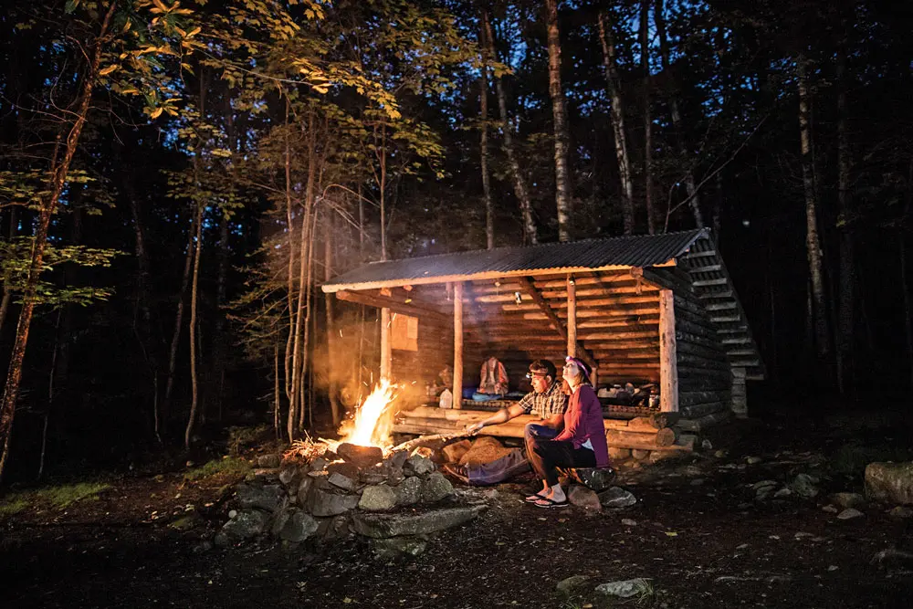
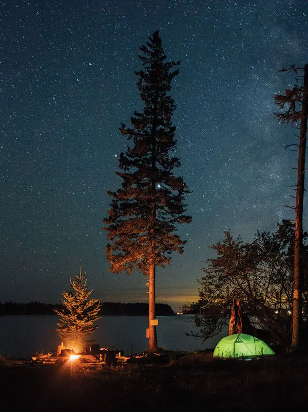
Clockwise from top left: camping at Bald Mountain Pond, where the Trust for Public Land has protected more than 2,000 acres (photo by Chris Bennett); Maine Coast Heritage Trust’s Monroe Island, in Owls Head (photo by Dave Waddell); Harpswell Heritage Land Trust’s Potts Point Preserve (photo by Benjamin Williamson).
One outgrowth of that work is the Wáhsehtəkw project, which is on track to become the country’s largest land return — 30,000 acres — to ever occur between a nonprofit and a tribal nation. In 2022, the Trust for Public Land took out loans to purchase the parcel, adjacent to Katahdin Woods and Waters, from timberland investors for $30 million, a sum the Penobscot Nation wouldn’t have come up with on its own. Once loans are paid off — the target is the end of next year — the trust will transfer ownership to the tribe. “Ultimately, this is the power that a land trust or conservation group can have — especially a larger, national one, like Trust for Public Land,” says Darren Ranco, a University of Maine anthropology professor, Penobscot Nation citizen, and executive director of the Wabanaki Commission on Land and Stewardship. “They could take out loans to purchase it, buy the time to raise the funds, and then turn it over to the Penobscot Nation.”
Those 30,000 acres come without restrictions, meaning that the tribe has total sovereignty over how they manage the land. Much of First Light’s mission is about building mutual understanding between conservation groups and tribes that their goals for the land align in crucial ways. For the tribes, Ranco says, reacquiring land isn’t just about ownership but about “fulfilling caretaking roles and responsibilities and creating access for our tribal citizens to care for places that we’ve been told we must care for. It’s part of our culture. Human beings, for most of the last 12,000 years, have been real positive influences on biodiversity, except for the last four or five hundred years. Forms of extractivism and capitalism linked to colonialism really destroyed biodiversity.”
“If you are getting land back that comes with lots of restrictions, then you cannot exercise your view for relating to that land,” says Tony Sutton, assistant professor of Native American studies and food systems at the University of Maine, Passamaquoddy tribal citizen, and member of the Wabanaki Commission on Land and Stewardship planning team. “By not having those restrictions in the context of indigenous land return, it allows people to express what their vision is for caring for that land or how their community members want to relate to that land.”
It might look like using fire practices to manage landscapes and encourage different plants used for food or medicine. “Indigenous management of the land,” Sutton says, “would depend on what the land is teaching you and what it’s offering and how you support that growth in a way that nourishes the land as well as nourishes your needs — it’s done in relation, so both the land and you are benefitting from management.”
Protecting the Future
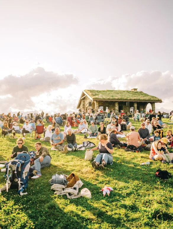
All across the state, land trusts have been doing work that otherwise wouldn’t get done. At Head of Tide Park, in Topsham, the Cathance River spills 15 feet into Merrymeeting Bay, a rare freshwater tidal delta and the only body of water to host all 12 of the Gulf of Maine’s diadromous species — that is, species that live in both fresh and salt water. One recent morning, a dad and son launched kayaks into the marsh. Beneath one of the park’s two shelters, a man relaxed at a picnic table, the Grateful Dead’s “Fire on the Mountain” tumbling from his speaker. A few signs piece together the parcel’s history, from the origin of its Abenaki name (“Kathanis” means “bent” or “crooked”) to its days as a feldspar mill. Miles of trails thread past backyards and into the woods, where ferns thrive and mosquitoes hum.
“This is really, in all of my career, one of my favorite conservation success stories,” says Angela Twitchell, who was executive director of the Brunswick-Topsham Land Trust when the park was created. For more than a decade, the trust worked closely with the town to piece together a number of separate properties, fundraising to support land purchases by both the town and the trust and to facilitate a land donation. It also helped demolish derelict apartment buildings that once stood on the grounds and assisted in planning everything down to signage, trails, and picnic areas.
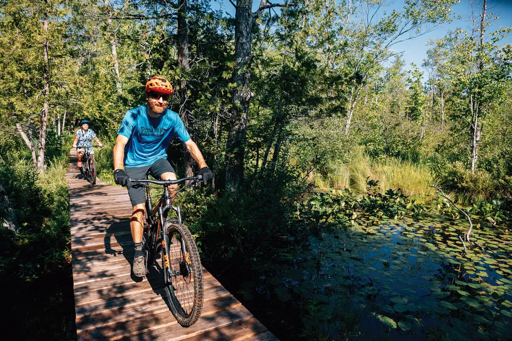
Clockwise from top left: Multiple trusts collaborated to help create Talking Brook Public Land, in New Gloucester and Auburn, now managed by the state’s Bureau of Parks and Lands (photo by Chris Bennett); trails on Maine Coast Heritage Trust’s Monroe Island, in Owls Head (photo by Dave Waddell); Western Foothills Land Trust’s Shepard’s Farm Preserve, in Norway (photo by Cait Bourgault).
“Land trusts continue to do that sort of traditional land-acquisition work,” Matt Markot says, “but we’re also doing so much more than that.” His group, Loon Echo Land Trust, has, for instance, partnered with other trusts in the Sebago Lake watershed as well as the Portland Water District and the Nature Conservancy on the Sebago Clean Waters initiative, aimed at protecting the quality of drinking water that flows from the lake into the homes of 250,000 Mainers by strategically conserving forests that prevent erosion, alleviate flooding, filter rainwater, and provide shade for fish. “It’s an indication of the very real and sincere partnership that land trusts have with the communities they serve,” Markot says.
Loon Echo, though, still does plenty of traditional land conservation. Its first parcel, the 128-acre Mayberry Hill Preserve, in Casco, was donated in 1990. Roads and homes bound the preserve, but from its parking lot, a trail skirts a backyard and quickly enters the woods, where an orchestra of bugs thrums in warm weather. Stone walls crisscross the trail, reminders of old property lines. Privately conserved lands in Maine might look like a chaotic jumble of pink on a map, but they hang together with the invisible threads of kitchen-table conversation, endless paperwork, phone calls, emails, coffees, and conference-room meetings that will keep them protected for generations to come. Wandering through the quiet woods of Mayberry Hill Preserve, it’s easy to see their value.