Text by Lindsey Moran
Photos by Cait Bourgault and the women of AWC
From our July 2018 issue
[cs_drop_cap letter=”W” color=”#000000″ size=”5em” ]hen I first got into hiking, climbing, and the outdoors, I had a hard time finding other women with whom to enjoy my hobbies. At times, I felt like an imposter, an outsider in a macho culture that emphasized performance over enjoyment. Maine natives Sarah McLean and Cait Bourgault felt the same way. When they founded the Alpine Women Collective in 2016, they were a pair of Portland creatives increasingly pulled to the mountains on weekends. As they realized how much hiking was improving their lives and friendship, they started organizing “babe hikes,” group hikes and camping trips where women of all ages (especially outdoor newbies) could hit the trail with a crew of supportive peers. “There’s just this irreplaceable team mentality and energy,” McLean says. “It’s the same camaraderie that brought Cait and me to the mountains.”
McLean, a graphic designer, and Bourgault, a photographer (and regular Down East contributor) launched a website and a hashtag on the photo app Instagram — and an upbeat digital community has since evolved around #alpinewomencollective, with women sharing hiking pics and tons of encouragement. AWC hikers log a lot of miles in New Hampshire’s White Mountains, but as McLean says, “Maine and its mountains are special to us. We’ve grown up appreciating how beautiful it is to find yourself in the outdoors here.”
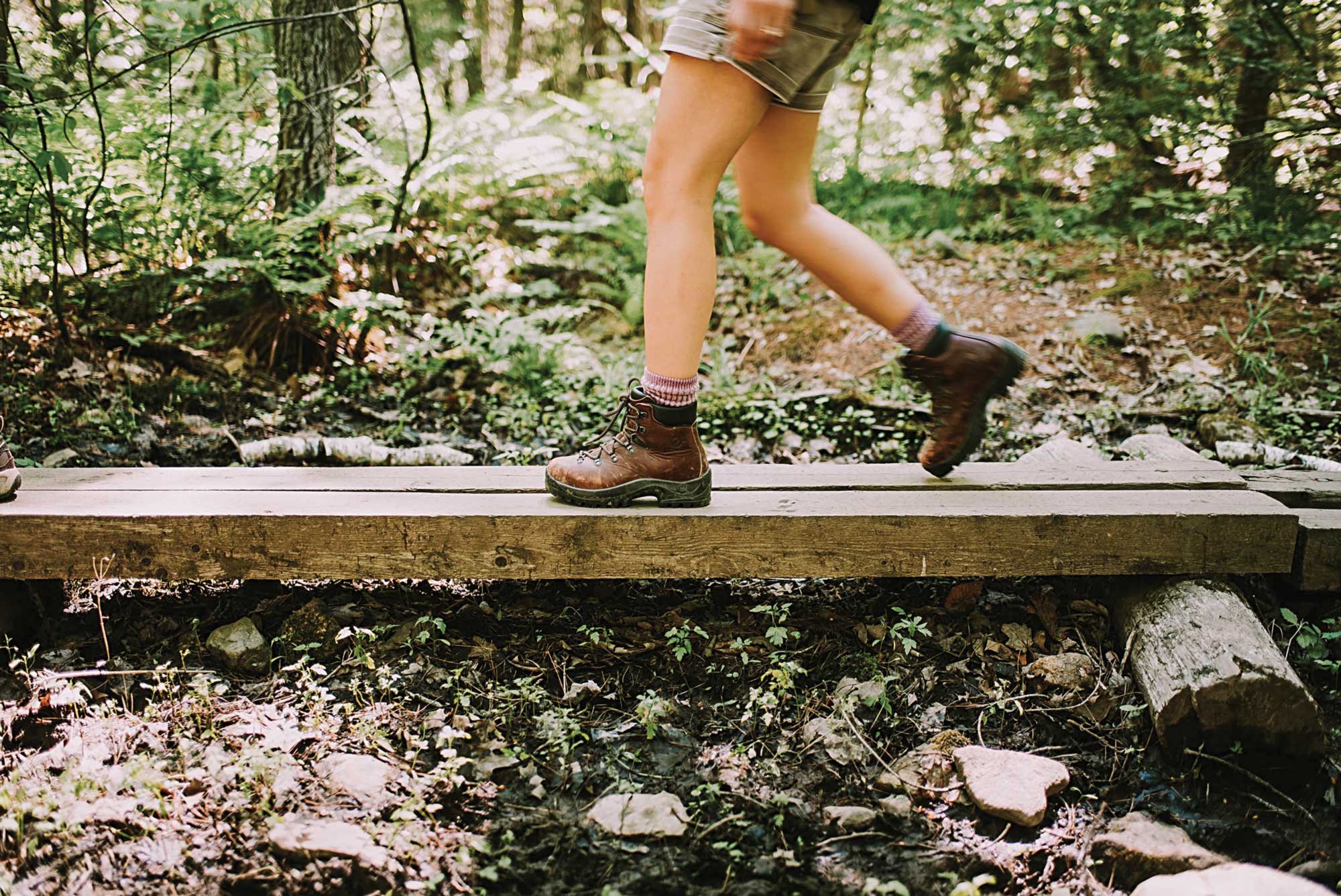
Below, find 10 of Maine’s best mountain hikes for all skill levels, with pics and insight from McLean, Bourgault, and other AWC hikers. Then get yourself to a trailhead this summer. Because no one is an imposter in the mountains.

“A Pleasant Mountain ‘babe hike’ started it all for me — amazing group energy and the views to match. I’ve since hiked in the Whites, traveled to Washington’s North Cascades with AWC, and gone back to Pleasant for my first-ever solo hike.”
— Kaitlin Callender, @cmykaitlin


Blueberry Mountain
Length: 3.6-mile loop, with optional spurs
Difficulty: Moderate to high, with some scrambling
In the Caribou-Speckled Mountain Wilderness, the summit of Blueberry Mountain shows off the stunning topography of Evans Notch and the White Mountains to the west. Start by heading up the White Cairn Trail, which is gentle for nearly a mile before a steep push to the summit ridge. Enjoy the views, then head down the summit trail to this hike’s real gem: the cool, Caribbean-clear waters of Rattlesnake Pool, one of Maine’s loveliest swimming holes.
► Trailhead on Shell Pond/Stone House Rd. off Rte. 113 in Stow, 1 mile south of Basin Rd. (turnoff on New Hampshire side).
Traveler Mountain
Length: 11 miles
Difficulty: High, with steep ascents and plenty of scrambling
In Baxter State Park’s wild northeastern corner, triple-peaked Traveler Mountain is as rugged and rewarding as its southern neighbor, Katahdin, but with a fraction of the hiker traffic. The 11-mile Traveler Loop begins at South Branch Pond Campground, tops out at 3,541 feet, and stays above treeline for nearly half its length. The views from the ridge — of nearby peaks, South Branch Pond, and the wavy forest floor — are constant and eye-popping. A tough hike that pays off with unsurpassed solitude and scenery.
► Trailhead at South Branch Pond Campground, 9 miles southwest of Matagamon Gate on the park’s Tote Rd.
Tunk Mountain
Length: 3.6 miles out and back, with an optional mile-long loop spur
Difficulty: Low to moderate, with a few metal rungs near the summit
The first mile of this classic Down East hike is forested and gentle, with an optional loop winding past two marshy ponds — watch for waterfowl and the occasional moose. The second half ascends some 700 feet up exposed ledges, with lovely views of scattered ponds below and nearby wind turbines. Part of the Maine Bureau of Parks and Land’s Donnell Pond Reserved Land, the trail’s been kept up nicely in recent years and doesn’t see much foot traffic.
► Trailhead on Rte. 182, on the Blackwoods Scenic Byway, 8.8 miles west of Rte. 1 in Cherryfield.
Pleasant Mountain
Length: 3.6 miles out and back, along the Ledges Trail
Difficulty: Moderate
Four different approaches reach the main summit of Bridgton’s 2,006-foot Pleasant Mountain, but the Ledges Trail is the most popular and direct. The summit view extends clear to Mount Washington on a good day, with rolling wooded hills and the sculpted Saco River Basin in between. On a nice summer day, you won’t have this trail to yourself, but the rocky, open summit can accommodate a crowd. Alas, the old fire tower is boarded up, but it still cuts a nice profile against the sky.
► Trailhead is on Mountain Rd., 3.2 miles south of Rte. 302 in Bridgton.
“Each time I’m on the trail with these ladies, or I see a fellow babe crushing goals on (and off) the mountain, I’m overcome with gratitude for this special place for women.”
— Courtney McKenna, @mscmckenna
Cadillac Mountain
Length: 7 miles out and back, along the South Ridge Trail
Difficulty: Moderate to high, with some rungs
Plenty drive to the summit, and while Cadillac’s North Ridge Trail is gorgeous, hikers have to see and hear all those cars. By contrast, the South Ridge Trail up the East’s tallest coastal peak has a backcountry feel. The trail climbs through mixed woods to a series of ledges with a few metal rungs to climb and terrific ocean views. The quiet mountain pond known as the Featherbed is a perfect picnic spot. Set aside a whole day so you can linger (with the crowds) at the summit.
► Trailhead on Rte. 3 in Acadia National Park, ½-mile northeast of Park Loop Rd., across from Blackwoods Campground entrance. Park on the shoulder.


Mount Kineo
Length: 2.8 miles via the Carriage and Bridle trails, with longer and steeper routes available
Difficulty: Low to moderate
With its sheer southeastern face dropping off like a countertop, 1,788-foot Mount Kineo is unmistakable, a fat granite wedge jutting up over Moosehead Lake. Most hikers get to its foot aboard the shuttle from the Rockwood Public Landing ($12, cash only, 207-534-9012). Follow the Carriage Trail along the shore and ascend via the Bridle Trail for the most gradual route (more ambitious hikers can circumnavigate the whole peninsula). The summit view is the best look at Moosehead Lake you can get outside of a Cessna.
► Trailhead begins at the Mount Kineo dock.
Mount Abraham
Length: 9.1 miles round-trip along the Fire Warden Trail
Difficulty: High, with talus fields, steep slopes, and scrambling
One of Maine’s 14 rugged 4,000-footers, Mount Abraham is as breathtaking as the hike up is challenging. The Fire Warden Trail gains some 3,000 feet in 4 ½ miles, and the last mile is a lungbuster, largely marked by cairns as hikers traverse talus and boulder fields above treeline. Views of nearby Spaulding and Sugarloaf mountains are out of this world. Bring plenty of layers for the summit and set aside a long day, both for the challenge and to explore the state’s second-largest alpine zone.
► Trailhead on Rapid Stream Rd., 6 miles west of Rte. 27 via West Kingfield Rd. in Kingfield. (You’ll need your Gazetteer for this one.)
Tumbledown Mountain
Length: Multiple loop and out-and-back routes from 3 to 6 miles
Difficulty: Moderate to high, with a steep ascent on the Parker Ridge Trail and a gentler elevation gain on the Brook Trail
The 2-mile Loop Trail to Tumbledown’s summit is the most taxing approach, but arguably the most fun, as hikers squeeze between boulders (including the famously narrow chimney known as Fat Man’s Misery) and tread exposed cliffs. The Brook Trail is less relentlessly vertical. Whatever approach, the payoff comes just shy of the peak — Tumbledown Pond, an oh-so-blue high-country lake surrounded by
exposed granite, where hikers picnic and swim.
►Trailheads along Weld to Byron Rd., 4 to 6 miles west of Rte. 142 in Weld.
Mount Agamenticus
Length: Multiple loop and out-and-back routes from 1 to 3 miles
Difficulty: Low to moderate
Agamenticus is a 692-foot playground of woods and rocky ledges in an otherwise developed and fairly flat corner of the state. A sprawling trail network (much of it shared with mountain bikers) covers the rounded peak and extends onto neighborhing hills. The 1½ -mile Ring Trail loop is the best way to explore, ascending through grouse-filled woods with multiple spurs to the summit. The most fun is the ¼-mile Blueberry Bluff Trail, which winds up scrubby granite cliffs to reach the developed summit, where there’s a viewing platform and interpretive center.
► Trailhead on Mountain Rd., 4 miles west of Rte. 1 in York.
"That boulder chimney on Tumbledown challenged me, but it also taught me that with help from friends, and the desire to try something new, I could make it to the pond. And did I ever. The views from atop Tumbledown are gorgeous!"
— Kaiulani Anderson-Andrei, @kaiudanielle
Mount Megunticook
Length: 3.5 miles out and back, via Mount Megunticook Trail, with longer loop options
Difficulty: Moderate
With a handful of lookouts and spur trails along the way and only a couple of steep segments, the Mount Megunticook Trail makes for a mildly aerobic mountain stroll (and a fantastic fall-foliage hike). At 1,385 feet, the highest of the Camden Hills is also a contender for having the best views in any state park outside of Baxter. The view at Ocean Lookout, a little below the summit, takes in Camden Harbor and the islands of Penobscot Bay.
► Trailhead at western edge of park campground. 280 Belfast Rd.(Rte. 1).
“I’ll never forget Mount Megunticook, not because of the awesome ocean views, but because it was where I joined a tribe of accepting, supportive, and adventurous women I never thought I’d find.”
— Shay Ruggles, @sruggles

Ocean Lookout on Mount Megunticook. 📷 Cait Bourgault